


Precinct 78, Caddo Parish, Louisiana
About
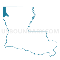
Outline

Summary
| Unique Area Identifier | 588244 |
| Name | Precinct 78 |
| County | Caddo Parish |
| State | Louisiana |
| Area (square miles) | 1.17 |
| Land Area (square miles) | 1.17 |
| Water Area (square miles) | 0.00 |
| % of Land Area | 100.00 |
| % of Water Area | 0.00 |
| Latitude of the Internal Point | 32.41555410 |
| Longtitude of the Internal Point | -93.75274200 |
Maps


Graphs
Select a template below for downloading or customizing gragh for Precinct 78, Caddo Parish, Louisiana


Neighbors
Neighoring Voting District (by Name) Neighboring Voting District on the Map
- Precinct 4, Caddo Parish, LA
- Precinct 51, Caddo Parish, LA
- Precinct 52, Caddo Parish, LA
- Precinct 59, Caddo Parish, LA
- Precinct 79, Caddo Parish, LA
- Precinct 97, Caddo Parish, LA
Top 10 Neighboring County Subdivision (by Population) Neighboring County Subdivision on the Map
- District 9, Caddo Parish, LA (27,649)
- District 10, Caddo Parish, LA (20,162)
- District 6, Caddo Parish, LA (17,745)
Top 10 Neighboring Place (by Population) Neighboring Place on the Map
Top 10 Neighboring Unified School District (by Population) Neighboring Unified School District on the Map
Top 10 Neighboring State Legislative District Lower Chamber (by Population) Neighboring State Legislative District Lower Chamber on the Map
Top 10 Neighboring State Legislative District Upper Chamber (by Population) Neighboring State Legislative District Upper Chamber on the Map
- State Senate District 38, LA (120,165)
- State Senate District 37, LA (114,690)
- State Senate District 39, LA (107,940)
Top 10 Neighboring 111th Congressional District (by Population) Neighboring 111th Congressional District on the Map
Top 10 Neighboring Census Tract (by Population) Neighboring Census Tract on the Map
- Census Tract 241.04, Caddo Parish, LA (6,660)
- Census Tract 237, Caddo Parish, LA (6,597)
- Census Tract 238, Caddo Parish, LA (6,377)
- Census Tract 239.03, Caddo Parish, LA (4,014)